Managing Our Flood Risk
Proper watershed management is the first step to lessening disastrous flooding.
Exactly what is a watershed?
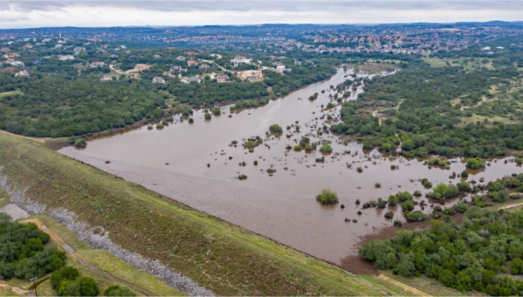
It is all the land area that drains water into a common place, usually a river, stream or lake. Weather events happening miles and miles away from these bodies of water can dramatically affect their levels, flow and intensity and cause severe flooding.
Implementing appropriate management practices is important to sustaining and enriching life in the San Antonio River Watershed and control the devastating effects of flooding. The goal of the River Authority is to reach a sensible balance between physical, chemical, biological and economic factors while still maintaining the integrity of the watersheds throughout the San Antonio River Basin.
Because these factors are always evolving, an effective watershed management plan involves a never-ending cycle of planning, assessing, and implementing.
Here’s a closeup look at a Watershed Management Cycle:
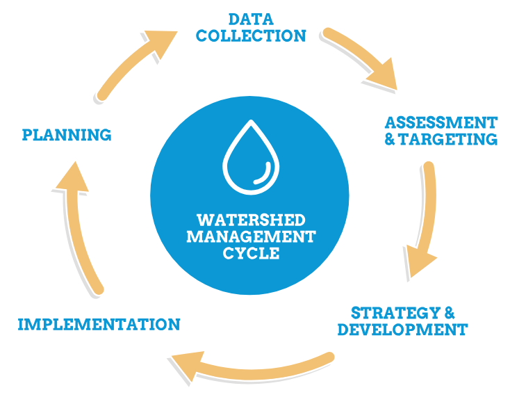
Collect water at specific locations and test to gather specific data.
Compare current water quality to state and federal standard or establish desired future conditions.
Develop goals and strategies to maintain or achieve water quality standards and meet future demands.
Implement goals and strategies through public policy, best management practives (BMPs) and education.
Determine the specific watershed and issues to be studied. Identity the stakeholders and resource personnel.
The River Authority constantly measures results to make sure the watershed management plan is performing at its highest level and adjust the program where needed.
Data Driven. Scientist Approved.
Another invaluable tool for flood control is a Watershed Master Plan.
It helps educate everyone about changes in land use, potential new building projects and modifications to regulations governing development within the basin. It’s particularly important as an information tool for decision makers whose actions and policies can affect the health of a watershed.
As the regional technical planning lead in watershed management, the San Antonio River Authority has made significant investments in collecting and maintaining watershed data and developing complex analytical tools and models to make scientifically sound watershed management recommendations.

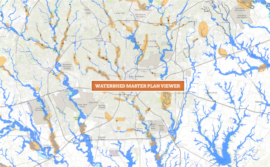
What's in Your Watershed?
The Watershed Master Plan Viewer displays information from the various Watershed Master Plan reports, as well as other useful reference data. This tool assists the stakeholders, decision-makers, and the public visualize and understand the challenges and potential solutions to watershed management. Explore your watershed using our Watershed Master Plan Viewer: