San Antonio River Tunnel

San Antonio River Tunnel

The San Antonio River flood diversion tunnel is approximately 16,200 feet long with precast concrete segmented liners of 24 feet by 4 inches inside diameter. The tunnel starts near Josephine Street where the tunnel inlet shaft is constructed adjacent to the existing channel (See Figure 2 for the tunnel’s route). The inlet shaft is 24 feet by 4 inches in diameter dropping approximately 118 feet to the tunnel invert. The tunnel outlet shaft near Lone Star Boulevard is 35 feet in diameter and contains embedded piping for dewatering facilities.

The tunnel intake shaft is located between West Josephine Street and Highway 281 North (See the figure below for profile of the San Antonio River Tunnel). Borden’s Dairy is on the west side of the river and a small manufacturing plant is located on the east side of the river.

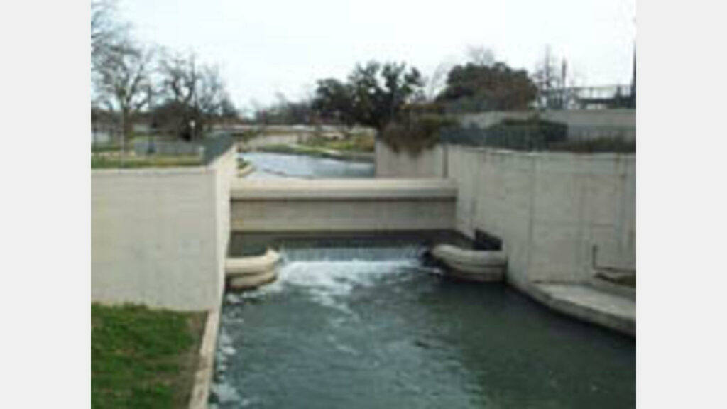
The tunnel outlet structure is located south of the Southern Pacific Railroad, north of Lone Star Boulevard and west of the river.

Construction for the San Antonio River Tunnel Inlet Structure started in September 1993. The contractor, BRH Garver, constructed a water feature, park facilities, betterments, channelization and tunnel recirculation for the flood control tunnel. A pumphouse was also constructed, mostly below ground level to operate pumps to recirculate tunnel water to supplement river flow during the summer months. This project is a coordinated effort between the U.S. Army Corps of Engineers and the San Antonio River Authority. The Corps bid the project on behalf of the River Authority. Total construction cost was $16.9 million.

Notice to proceed for the San Antonio River Tunnel Outlet Structure was given to Martin K. Eby Construction Company, Inc. on May 5, 1995 and the project was completed in December 1997 at a total cost of $10.1 million. This project includes a water feature, a galvanized steel trellis over a pedestrian plaza, park facilities, betterments, channelization and a gatehouse for tunnel water recirculation. The project was jointly administered by the U.S. Army Corps of Engineers and the San Antonio River Authority.
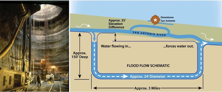
The San Antonio River Tunnel graphic

Project Goals:

Safe

Project Details:

Share:

Facebook
Twitter
LinkedIn
Email

Related Projects

This project will assess the long-term space needs of the River Authority and evaluate various options regarding new building designs for the property located at…
This project will begin design and construction on Mann’s Crossing Park on the Medina River, Hendrick Arnold Park (Straus medina), Trueheart Ranch, and Espada Park.…
The San Antonio River Authority is collaborating with the US Army Corps of Engineers to restore portions of the Westside Creeks, including portions of San…

Alerts

SASPAMCO Paddling Trail Temporarily Closed

Staff have removed two large log jams just downstream of Helton Nature Park, keeping the southern portion of the SASPAMCO Paddling Trail temporarily closed. Staff are working to contact adjacent landowners to support a land-based removal solution.

Stem Density Efforts

Please be advised that trails near the Confluence Park and Conception Park area will be temporarily closed due to ongoing Stem Density efforts. We appreciate your cooperation and ask that you remain mindful of workers and closures when in the vicinity. Thank you for your patience as we work to improve our natural spaces!


West Bank Trail Closure Notice

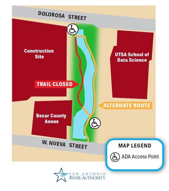
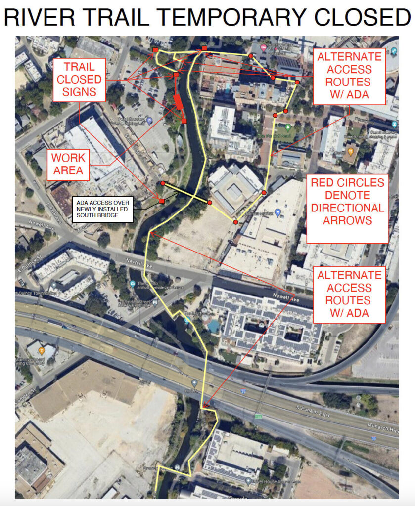
Due to the construction of a new trail and bridge, the West Bank of the trail between Schiller St. and Newell St. will be closed for the next couple of months. The East Bank will also be intermittently closed on Monday, November 4th, to install the bridge. Please use caution when navigating around this area. We apologize for any inconvenience.

Please refer to the map for reference. 

San Pedro Creek Culture Park

The restrooms at South Alamo will be temporarily closed for maintenance and repairs. We apologize for any inconvenience and appreciate your understanding. 

Acequia Trail Notice

The Acequia trail will have heavy traffic near MROC starting May 22nd until further notice. The SAWS Acequia project will be bringing in crews to work on the lift station site and across the street. There will have flaggers to stop traffic, please use caution. 

SASPAMCO Paddling Trail

The SASPAMCO paddling trail is open from River Crossing Park to Helton Nature Park.
*Please Note: Paddling Trail from Helton Nature Park to HWY 97 is still closed due to blockages. 

River Reach Newsletter and Blog Signup

River Reach is offered as a printed, physical mailing to your residence or business. The Blog is a weekly electronic email with news and updates in order to be more environmentally conscious. Please fill out the form below and indicate your preferred method of delivery.

By submitting this form, you are consenting to receive marketing materials from: San Antonio River Authority, 100 East Guenther St., San Antonio, TX, 78204, US. You can revoke your consent to receive emails at any time by using the SafeUnsubscribe® link, found at the bottom of every email. Emails are serviced by Constant Contact. This site is protected by reCAPTCHA and the Google Privacy Policy and Terms of Service apply.