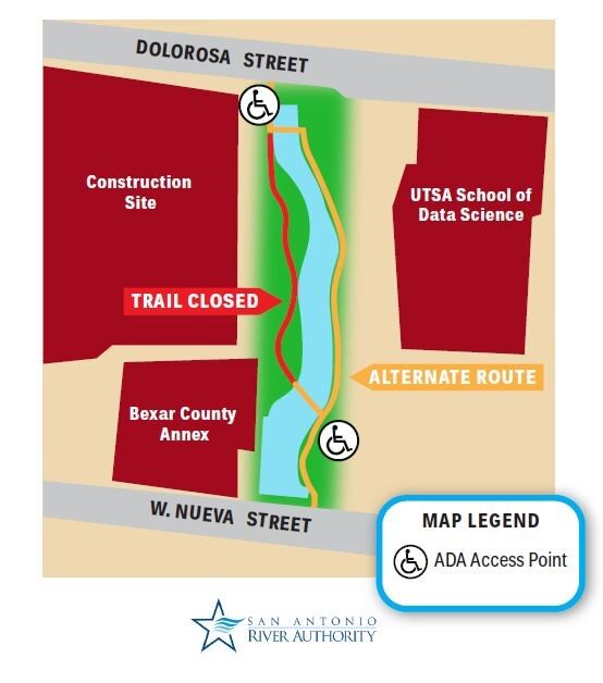
The San Antonio River Authority Floodplain Viewer engages users in an interactive floodplain map, displaying the Federal Emergency Management Agency’s (FEMA) National Flood Hazard Layer (NFHL) data. Together with its many Bexar Regional Watershed Management (BRWM) partners, the San Antonio River Authority performs engineering studies to develop the data used in these digital maps, providing basic information about the floodplains in Bexar, Wilson, Karnes and Goliad counties.

Graytown Park Parking Lot Construction Notice
Construction Timeline: April – October 2025 (estimated)
Improvements are coming to Graytown Park! Parking lot construction will begin in April, and we appreciate your patience as we work to enhance the park for all visitors.
Temporary Closures & Impacts:
- Upper parking area, pavilion, and restrooms will be CLOSED during construction. Temporary restroom facilities will be provided.
- Park and river access will be CLOSED Monday–Friday from 8 AM – 5 PM (no access during these hours).
We encourage visitors to plan accordingly and check back for updates as the project progresses. Thank you for your support!
Stay Updated: Follow us on social media for the latest updates.