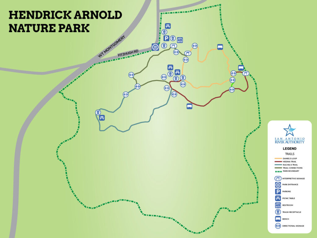
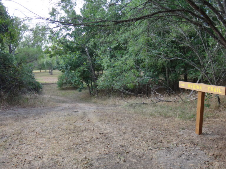
Hendrick Arnold is open to the public and currently has several trails available to explore. “Daniels Loop”, “Medina Trail”, and “Rachels Trail” are open at the park.
Hendrick Arnold Nature Park contains 74 acres of riparian woodland that fronts on the Medina River. The site, with the exception of the creek bank, was extensively mined for gravel. The mining ended in 1940 allowing riparian growth to cover the site creating one of the few remaining woodland creeks properties in Bexar County. The San Antonio River Authority purchased the property with plans to develop it as a nature interpretive and educational park. This master planning effort is the first step toward a comprehensive long-range visioning process to identify areas for preservation and interpretation while preserving as much of the site as possible.
Four alternative concepts were developed utilizing a workshop process to establish priorities, develop concepts, and build consensus. These plans were presented at a public meeting and ranking was developed for features to be included in the master plan and also to set priorities for the development of these features. The park should have a number of management zones including a river / riparian zone, a forest and wildlife zone and an activity zone. Within each of these zones, different maintenance, management, and improvement guidelines and levels were recommended.
Park Amenities Coming Soon:
- Park Main Gateway
- Interpretation
- Group Camping
- Picnic Area
- Nature Playground
- Outdoor Classroom
- Equestrian staging facility
- RV parking
- Internal roadway and parking
- Trailheads with restrooms
- Multipurpose trail
- Equestrian trail
- Interpretive Trail
- Bird watching stations
- River Boating Access Points
Park Gallery:

Park Map:
Park Details:
- 8950 Fitzhugh Rd, San Antonio, TX 78252
- Hours: Daily, Dawn to Dusk
- Admission Fee: Free
- Park Size: 74 Acres
- Reservations: Not Available at this time
Downloadable Resources:
San Antonio River Basin Guide
A collection of parks, trails, and historic destinations throughout the San Antonio River Basin, including Bexar, Wilson, Karnes and Goliad Counties as well as the San Antonio River Walk (Downtown, Museum Reach and Mission Reach).


