While all the metrics in the San Antonio River Basin Report Card have overlapping correlation to the safe, clean, enjoyable creeks and rivers aspects of the River Authority’s mission, the Green Infrastructure for Stormwater Quality grade is primarily related to the clean aspect.
As more natural surfaces are paved and developed, less water percolates into the ground and more water instead flows over impervious surfaces and into storm drains, picking up pollutants and carrying them to creeks and rivers. The untreated rainwater that goes into storm drains and directly to our creeks and rivers is known as stormwater runoff. Stormwater in San Antonio River Basin communities is not treated at wastewater treatment plants. The pollutants picked up by stormwater include, but are not limited to, oil, fertilizers, bacteria, heavy metals, gasoline, and sediment. Stormwater runoff (or non-point source pollution) is the most significant contributor to water quality degradation in the San Antonio River Basin. It is also the most difficult to control because runoff pollution is potentially caused by every one of the more than 2 million people who live in the basin.
Data from River Authority water quality monitoring indicates that pollutants carried by stormwater runoff are the greatest threat to river basin health. To generate lasting and recognized improvements in river basin health requires the use of green infrastructure practices in land development and management that mimic the natural, pre-development hydrology of the land. The benefits of these sustainable practices include reducing the volume and velocity of stormwater flow that is generated when rainwater hits impervious cover instead of pre-developed lands. Benefits also include filtration of pollutants carried by stormwater flow before the stormwater enters creeks and rivers, and decreasing erosion and its negative effects on both stream banks and community infrastructure such as bridge supports in creek beds.
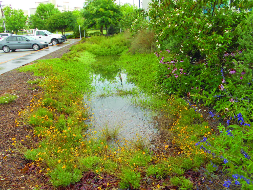
In the long run, projects that incorporate sustainable, green infrastructure will decrease the amount of new infrastructure and infrastructure retrofits required to manage floodwater generated by ever-increasing development, conserve and utilize rainwater as a valuable resource, add more green space, use native vegetation that provides pollination and habitat benefits, provide air quality benefits, reduce urban heat island effects, and reduce costly pollution and erosion mitigation. Green infrastructure, therefore, helps to balance the environmental, economic, and quality of life benefits for the surrounding area.
Grade for 2022:
C+
How is this being measured?
The Green Infrastructure for Stormwater Quality metric in the San Antonio River Basin Report Card uses the Environmental Protection Agency (EPA) Water Quality Scorecard for Incorporating Green Infrastructure Practices at the Municipal, Neighborhood, and Site Scales. The two main goals of the EPA’s water quality scorecard tool are to: “(1) help communities protect water quality by identifying ways to reduce the amount of stormwater flows in a community and (2) educate stakeholders on the wide range of policies and regulations that have water quality implications.”
The EPA’s water quality scorecard tool includes a point system to make it easier to evaluate and improve.
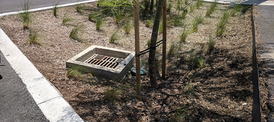
local programs. The scorecard allocates “points available” across a variety of areas within five primary sections addressing Protection of Natural Resources (Including Trees) and Open Space; Promotion of Efficient, Compact Development Patterns and Infill; Design of Complete, Smart Streets that Reduce Overall Imperviousness; Encouraging Efficient Parking; and Adoption of Green Infrastructure Stormwater Management Provisions.
Explanation of the Grade
Section 1: Protection of Natural Resources (Including Trees) and Open Space
Loading..........
The Data is Not Available
Section 2: Promote Efficient, Compact Development Patterns and Infill
Loading..........
The Data is Not Available
Section 3: Design Complete, Smart Streets That Reduce Overall Imperviousness
Loading..........
The Data is Not Available
Section 4: Encourage Efficient Parking
Loading..........
The Data is Not Available
Section 5: Adopt Green Infrastructure Stormwater Management Provisions
Loading..........
The Data is Not Available
Loading..........
The Data is Not Available
Loading..........
The Data is Not Available
Key Findings
The overall grade for this metric is a 53%, which equates to a “C” letter grade which is the same grade as last year. A “C” grade for this metric indicates that some successful work has been done in the Bexar County/City of San Antonio area related to green infrastructure, but more can be done to help protect and improve water quality in the San Antonio River Basin.
Of the five categories in the EPA’s water quality scorecard, Section 1, Protection of Natural Resources (Including Trees) and Open Space, scored the best, receiving 53 of 82 points available or 65%. Section 5, Adopt Green Infrastructure Stormwater Management Provisions, scored the second highest of the categories, receiving 22 of 39 points available or 56%. Section 4, Encourage Efficient Parking, received the lowest score by category, receiving 18 of 41 points available or 44%.
For this fourth San Antonio River Basin Report Card, this green infrastructure metric has generated a grade related to work being done in Bexar County and the City of San Antonio area. This area is in the upper section of the San Antonio River Basin and is the largest urban population within the basin. Pollution entering the creeks and rivers in the Bexar County/City of San Antonio area has the potential to cause concerns throughout the basin; therefore, implementing green infrastructure practices in the upper reaches of the basin can also provide benefits further downriver. A “C” grade, being average, does show some promising results. To raise this grade in the coming years, more can be done in terms of encouraging, incentivizing, and/or mandating green infrastructure and confirming proper maintenance of green infrastructure features to ensure the stormwater reaching area creeks and rivers has been treated for water quality and slowed down to reduce erosion and contribution to flood flows.
Scoring only the sustainable practices of the Bexar County and City of San Antonio area is a known limitation of the grade for the basin report card. The rural land use practices of the southern basin may also impact the health of the river basin. Therefore, it is the River Authority’s intent to expand the use of the EPA’s water quality scorecard, where feasible, to include grading sustainability work being done in Wilson, Karnes, and Goliad counties as well. By expanding the use of the EPA’s water quality scorecard into the more rural areas of the San Antonio River Basin, we believe the grade for this green infrastructure metric, in time, will more accurately reflect the reality of the entire basin and can be used to inspire actions for healthy creeks and rivers in both the urban and rural areas of the San Antonio River Basin.
Recommended Actions
As with most other watersheds in the United States, development within the San Antonio River Basin has modified the natural function of the basin. In the San Antonio River Basin, infrastructure has been built to direct stormwater runoff into nearby creeks and rivers. This is especially problematic in urban areas during small rain events, where the high concentration of “first flush” pollutants can reduce a waterway’s dissolved oxygen, resulting in fish kills and building concentrations of other containments in the sediment of the waterways bed.
Ensuring the sustainability of creeks and rivers, and the bays and estuaries into which they flow, involves creating projects, incentives, and policy toward reduction of direct runoff and capitalizing on the land’s natural ability to filter pollutants. Green Infrastructure (GI) is a stormwater management strategy that works to replicate the predevelopment hydrologic processes and reduce the harmful impacts of urban runoff. GI techniques have been shown to improve water quality, reduce localized flooding, and when incorporated into a project’s design early in the process, reduce overall long-term costs.
A first step to improving GI use throughout the San Antonio River Basin is for more people to understand this development technique.
The River Authority, in cooperation with Bexar County, has developed a training program for site planning, design, construction inspection, and maintenance of GI. The training program is comprised of four courses: Site Planning for LID Course, Design of Common LID Practices Course, LID Construction Inspection Course and LID Annual Inspection and Maintenance Course.
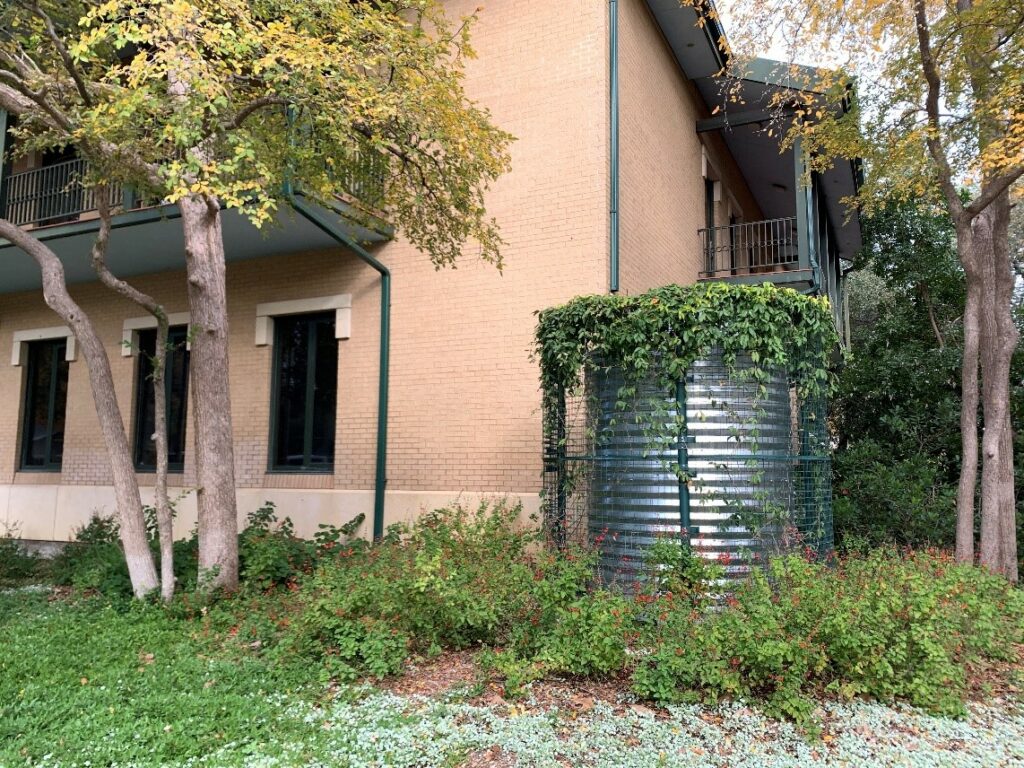
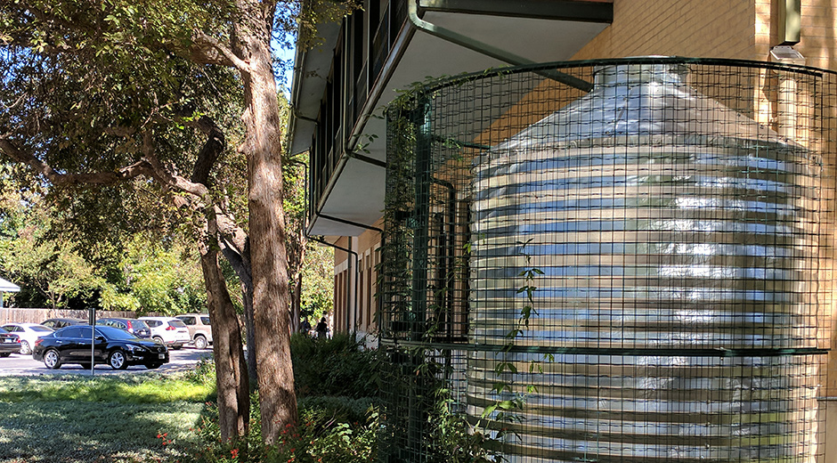
Residential homeowners are encouraged to implement GI on their property where feasible. Simple solutions include turning gutter downspouts to vegetated areas instead of draining to impervious surfaces like driveways, installing rain barrels or cisterns, and constructing a rain garden.
You can also join the River Warrior volunteers to actively participate in river stewardship projects as well as attend trainings and educational events to gain knowledge on green infrastructure strategies to become river protection ambassadors.
Finally, community support and demand for the use of green infrastructure is needed to increase the wide-spread use of the development technique. Residents of the San Antonio River Basin are encouraged to use your voice to support green infrastructure. Please follow and tag the River Authority on Facebook, Twitter, and Instagram and use #BeRiverProud to tell us your support for green infrastructure, and be sure to tell your elected officials as well.
Grade for 2021:
C
How is this being measured?
The Green Infrastructure for Stormwater Quality metric in the San Antonio River Basin Report Card uses the Environmental Protection Agency (EPA) Water Quality Scorecard for Incorporating Green Infrastructure Practices at the Municipal, Neighborhood, and Site Scales. The two main goals of the EPA’s water quality scorecard tool are to: “(1) help communities protect water quality by identifying ways to reduce the amount of stormwater flows in a community and (2) educate stakeholders on the wide range of policies and regulations that have water quality implications.”
The EPA’s water quality scorecard tool includes a point system to make it easier to evaluate and improve local programs. The scorecard allocates “points available” across a variety of areas within five primary sections addressing Protection of Natural Resources (Including Trees) and Open Space; Promotion of Efficient, Compact Development Patterns and Infill; Design of Complete, Smart Streets that Reduce Overall Imperviousness; Encouraging Efficient Parking; and Adoption of Green Infrastructure Stormwater Management Provisions.
For this year’s basin report card grade, we are continuing to use the EPA’s water quality scorecard and awarding points per category. The points are largely being awarded based on the Bexar County/City of San Antonio area of the San Antonio River Basin by using data captured from local projects as well as from regional GIS data and known code, policy, planning, and programming of other San Antonio River Basin governmental entities, including multiple departments from the City of San Antonio such as the Parks & Recreation Department, Sustainability Department, Planning Department, Development Services Department, and the Transportation & Capital Improvement Department. The final grade for this metric will be determined by dividing the total points awarded by the total points available and then multiple by 100.

Explanation of the Grade
Section 1: Protection of Natural Resources (Including Trees) and Open Space
Loading..........
The Data is Not Available
Section 2: Promote Efficient, Compact Development Patterns and Infill
Loading..........
The Data is Not Available
Section 3: Design Complete, Smart Streets That Reduce Overall Imperviousness
Loading..........
The Data is Not Available
Section 4: Encourage Efficient Parking
Loading..........
The Data is Not Available
Section 5: Adopt Green Infrastructure Stormwater Management Provisions
Loading..........
The Data is Not Available
Loading..........
The Data is Not Available
Key Findings
The overall grade for this metric is a 53.7%, which equates to a “C” letter grade. This increase from last year’s scores of 49.4% is due to the additional information provided by the City of San Antonio’s Parks & Recreation Department, Sustainability Department, Planning Department, Development Services Department, and the Transportation & Capital Improvement Department. This slight increase in the score from the previous year did not change the letter grade.
It should be noted, however, that no municipality in the United States will be able to receive every point available in the EPA water quality scorecard because the scorecard is intended for use by a range of community types and sizes in locations throughout the U.S. That said, a “C” grade for this metric indicates that some successful work has been done in the Bexar County/City of San Antonio area related to green infrastructure, but more can, and should, be done to help protect and improve water quality in the San Antonio River Basin.
Of the five categories in the EPA’s water quality scorecard, Section 1 (Protection of Natural Resources [Including Trees] and Open Space) scored the best. The order of the remaining sections, by percentage of available points per section, is Section 5 (Adopt Green Infrastructure Stormwater Management Provisions), Section 2 (Promote Efficient, Compact Development Patterns and Infill), Section 4 (Encourage Efficient Parking), and finally, Section 3 (Design Complete, Smart Streets That Reduce Overall Imperviousness) came in with the least points.
This green infrastructure metric has generated a grade related to work being done in Bexar County and the City of San Antonio area. This area is in the upper section of the San Antonio River Basin and is the largest urban population within the basin. Pollution entering the creeks and rivers in the Bexar County/City of San Antonio area has the potential to cause concerns throughout the basin; therefore, implementing green infrastructure practices in the upper reaches of the basin can also provide benefits further downriver. A “C” grade, being average, does show some promising results. To raise this grade in the coming years, more can be done in terms of encouraging, incentivizing, and/or mandating green infrastructure and confirming proper maintenance of green infrastructure features to ensure the stormwater reaching area creeks and rivers has been treated for water quality and slowed down to reduce erosion and contribution to flood flows.
It should also be noted that only scoring the sustainable practices of the Bexar County and City of San Antonio area is a known limitation of the grade for this year’s report card. The rural land use practices of the southern basin may also impact the health of the river basin. Therefore, it is the River Authority’s intent to expand the use of the EPA’s water quality scorecard in the coming years, where feasible, to include grading sustainability work being done in Wilson, Karnes, and Goliad counties as well. By expanding the use of the EPA’s water quality scorecard into the more rural areas of the San Antonio River Basin, we believe the grade for this green infrastructure metric, in time, will more accurately reflect the reality of the entire basin and can be used as inspire actions for healthy creeks and rivers in both the urban and rural areas of the San Antonio River Basin.
Recommended Actions
As with most other watersheds in the United States, development within the San Antonio River Basin has modified the natural function of the basin. In the San Antonio River Basin, infrastructure has been built to direct stormwater runoff into nearby creeks and rivers. This is especially problematic in urban areas during small rain events, where the high concentration of “first flush” pollutants can reduce a waterway’s dissolved oxygen, resulting in fish kills and building concentrations of other containments in the sediment of the waterways bed.
Ensuring the sustainability of creeks and rivers, and the bays and estuaries into which they flow, involves creating projects, incentives, and policy toward reduction of direct runoff and capitalizing on the land’s natural ability to filter pollutants. Green Infrastructure is a stormwater management strategy that works to replicate the predevelopment hydrologic processes and reduce the harmful impacts of urban runoff. These multi-benefit best management practices techniques have been shown to improve water quality, reduce localized flooding, and when incorporated into a project’s design early in the process, reduce overall long-term costs.
A first step to improving the use of green infrastructure throughout the San Antonio River Basin is for more people to better understand this development technique.
The River Authority, in cooperation with Bexar County, has developed a training program for the design, construction inspection, and annual operation and maintenance of green infrastructure. The training program is comprised of three courses: Site Assessment and Design Course, Construction Inspection Course and Annual Inspection and Maintenance Course.
While the River Authority’s rebate program does not fund green infrastructure for individual residential homes, homeowners are still recommended to implement these multi-benefit techniques on their property where feasible. Simple ways homeowners can help include turning gutter downspouts to vegetated areas instead of draining to impervious surfaces like driveways, installing rain barrels or cisterns, and constructing a rain garden.
You can also join the River Warrior volunteers to actively participate in ecosystem restoration projects as well as attend trainings and educational events to gain knowledge on green infrastructure strategies to become river protection ambassadors.
Finally, community support and demand for the use of green infrastructure is recommended to increase the wide-spread use of the needed development technique. Residents of the San Antonio River Basin are encouraged to use your voice to support green infrastructure. Please follow and tag the River Authority on Facebook, Twitter, and Instagram and use #BeRiverProud to tell us your support for green infrastructure, and be sure to tell your elected officials as well.
Grade for 2020:
C
How is this being measured?
The Green Infrastructure for Stormwater Quality metric in the San Antonio River Basin Report Card uses the Environmental Protection Agency (EPA) Water Quality Scorecard for Incorporating Green Infrastructure Practices at the Municipal, Neighborhood, and Site Scales. The two main goals of the EPA’s water quality scorecard tool are to: “(1) help communities protect water quality by identifying ways to reduce the amount of stormwater flows in a community and (2) educate stakeholders on the wide range of policies and regulations that have water quality implications.”
The EPA’s water quality scorecard tool includes a point system to make it easier to evaluate and improve local programs. The scorecard allocates “points available” across a variety of areas within five primary sections addressing Protection of Natural Resources (Including Trees) and Open Space; Promotion of Efficient, Compact Development Patterns and Infill; Design of Complete, Smart Streets that Reduce Overall Imperviousness; Encouraging Efficient Parking; and Adoption of Green Infrastructure Stormwater Management Provisions.
For the past decade, the River Authority has been a leader in advocating for and/or implementing green infrastructure stormwater management projects including natural channel design, green infrastructure and Low Impact Development (LID) projects and development code amendments. The River Authority has provided training on LID since 2012, growing its portfolio to include three LID credential courses in partnership with Bexar County and a number of LID presentations offered on request, including presentations on LID basics; LID design, construction, and maintenance errors to avoid; and the chemistry underlying LID stormwater management. Incorporating significant stakeholder involvement, the River Authority funded and managed creation of the San Antonio River Basin LID Technical Design Guidance Manual, first released in 2013 and updated in 2019 to include an additional LID feature requested by the development and design community.

In addition, the River Authority has advocated for incentives to encourage greater adoption of these alternative development and land management approaches. Two results are the City of San Antonio’s approval of incentives for LID and natural channel design during the 2015 Unified Development Code amendment cycle (see Article II, Section 35-210) and the River Authority’s Watershed Wise School Grant and Rebate Program launched in 2014. View completed projects and the volume of stormwater and pollutants being managed by those projects throughout the San Antonio River Basin.
For the City of San Antonio’s 2015 Unified Development Code (UDC) amendment cycle, the River Authority funded the stakeholder-driven project resulting in the February 2016 approval of a LID ordinance establishing the City’s LID fee and credit-offset incentives and the stormwater management standards required to receive them. In an effort to protect the public investment in the Museum Reach and the Mission Reach sections of the San Antonio River Walk, the River Authority also submitted an amendment to the River Improvement Overlay (RIO) District section of the UDC to mandate LID on developments abutting the San Antonio River in RIO’s 1-2 and 4-6. An update in 2017 incorporated San Pedro Creek into the RIO, thus providing protections to the then-future San Pedro Creek Culture Park improvements project.
The River Authority also has invested staff time and expertise to the City of San Antonio’s SA Tomorrow Comprehensive Planning process to advocate for open space, floodplain, and other sensitive natural feature protections; LID and green infrastructure; shared parking paradigms, green complete streets, and other innovative policies designed to decrease impervious cover while meeting human needs; multi-benefit projects; and, ultimately, protection of rivers, creeks, and streams. The River Authority has also participated in the City of San Antonio’s Climate Action and Adaptation Plan process, for which a River Authority director has recently been named an Organizational Member of the Technical & Community Advisory Committee. Through this work, the River Authority will guide the community in better understanding that green infrastructure is a development solution that addresses not only stormwater quality and quantity, but also climate, air quality, equity, and other issues of significance under the SA Climate Ready program.
For this year’s basin report card grade, we are using the EPA’s water quality scorecard and awarding points per category. The points are largely being awarded based on the Bexar County/City of San Antonio area of the San Antonio River Basin by using data captured from the above projects as well as from regional GIS data and known code, policy, planning, and programming of other San Antonio River Basin governmental entities. The final grade for this metric will be determined by dividing the total points awarded by the total points available and then multiply by 100.
Explanation of the Grade
Section 1: Protection of Natural Resources (Including Trees) and Open Space
Loading..........
The Data is Not Available
Section 2: Promote Efficient, Compact Development Patterns and Infill
Loading..........
The Data is Not Available
Section 3: Design Complete, Smart Streets That Reduce Overall Imperviousness
Loading..........
The Data is Not Available
Section 4: Encourage Efficient Parking
Loading..........
The Data is Not Available
Section 5: Adopt Green Infrastructure Stormwater Management Provisions
Loading..........
The Data is Not Available
Loading..........
The Data is Not Available
Key Findings
The overall grade for this metric is a 49.4%, which equates to a “C” letter grade. It should be noted, however, that no municipality in the United States will be able to receive every point available in the EPA water quality scorecard because the scorecard is intended for use by a range of community types and sizes in locations throughout the U.S. That said, a “C” grade for this metric indicates that some successful work has been done in the Bexar County/City of San Antonio area related to green infrastructure, but more can, and should, be done to help protect and improve water quality in the San Antonio River Basin.
Of the five categories in the EPA’s water quality scorecard, Section 5 (Adopt Green Infrastructure Stormwater Management Provisions) scored the best with Section 1 (Protection of Natural Resources [Including Trees] and Open Space) coming in as a very close second. There’s a significant drop in points between the top two Sections and the other three. Section 2 (Promote Efficient, Compact Development Patterns and Infill) and Section 4 (Encourage Efficient Parking) are also closely scored, but about 12 points further away than the top two Sections. Section 3 (Design Complete, Smart Streets That Reduce Overall Imperviousness) came in with the least points, by percentage of available points per section.
For this inaugural San Antonio River Basin Report Card, this green infrastructure metric has generated a grade related to work being done in Bexar County and the City of San Antonio area. This area is in the upper section of the San Antonio River Basin and is the largest urban population within the basin. Pollution entering the creeks and rivers in the Bexar County/City of San Antonio area has the potential to cause concerns throughout the basin; therefore, implementing green infrastructure practices in the upper reaches of the basin can also provide benefits further downriver. A “C” grade, being average, does show some promising results. To raise this grade in the coming years, more can be done in terms of encouraging, incentivizing, and/or mandating green infrastructure and confirming proper maintenance of green infrastructure features to ensure the stormwater reaching area creeks and rivers has been treated for water quality and slowed down to reduce erosion and contribution to flood flows.
It should also be noted that only scoring the sustainable practices of the Bexar County and City of San Antonio area is a known limitation of the grade for this year’s report card. The rural land use practices of the southern basin may also impact the health of the river basin. Therefore, it is the River Authority’s intent to expand the use of the EPA’s water quality scorecard, where feasible, to include grading sustainability work being done in Wilson, Karnes, and Goliad counties as well. By expanding the use of the EPA’s water quality scorecard into the more rural areas of the San Antonio River Basin, we believe the grade for this green infrastructure metric, in time, will more accurately reflect the reality of the entire basin and can be used as inspire actions for healthy creeks and rivers in both the urban and rural areas of the San Antonio River Basin.
Recommended Actions
As with most other watersheds in the United States, development within the San Antonio River Basin has modified the natural function of the basin. In the San Antonio River Basin, infrastructure has been built to direct stormwater runoff into nearby creeks and rivers. This is especially problematic in urban areas during small rain events, where the high concentration of “first flush” pollutants can reduce a waterway’s dissolved oxygen, resulting in fish kills and building concentrations of other containments in the sediment of the waterways bed.
Ensuring the sustainability of creeks and rivers, and the bays and estuaries into which they flow, involves creating projects, incentives, and policy toward reduction of direct runoff and capitalizing on the land’s natural ability to filter pollutants. Green Infrastructure (GI) is a stormwater management strategy that works to replicate the predevelopment hydrologic processes and reduce the harmful impacts of urban runoff. GI techniques have been shown to improve water quality, reduce localized flooding, and when incorporated into a project’s design early in the process, reduce overall long-term costs.

A first step to improving GI use throughout the San Antonio River Basin is for more people to understand this development technique.
The River Authority, in cooperation with Bexar County, has developed a training program for the design, construction inspection, and annual operation and maintenance of GI. The training program is comprised of three courses: Site Assessment and Design Course, Construction Inspection Course and Annual Inspection and Maintenance Course.
While the River Authority’s rebate program does not fund GI for individual residential homes, homeowners are still recommended to implement GI on their property where feasible. Simple ways homeowners can help include turning gutter downspouts to vegetated areas instead of draining to impervious surfaces like driveways, installing rain barrels or cisterns, and constructing a rain garden.
You can also join the River Warrior volunteers to actively participate in ecosystem restoration projects as well as attend trainings and educational events to gain knowledge on green infrastructure strategies to become river protection ambassadors.
Finally, community support and demand for the use of green infrastructure is recommended in order to increase the wide-spread use of the needed development technique. Residents of the San Antonio River Basin are encouraged to use your voice to support green infrastructure. Please follow and tag the River Authority on Facebook, Twitter, and Instagram and use #BeRiverProud to tell us your support for green infrastructure, and be sure to tell your elected officials as well.

