¿Qué tan bien conoces el río San Antonio?
La Autoridad del Río San Antonio (Autoridad del Río) fue creada en 1937 por el Estado de Texas para preservar, proteger y gestionar los recursos y el medio ambiente de la cuenca del río San Antonio. Nuestro personal es responsable de llevar a cabo nuestra visión de inspirar acciones para tener arroyos y ríos saludables armonizando las necesidades de las personas y la naturaleza a través de nuestra gestión de los ríos y la tierra. Puede encontrar más información sobre la Autoridad del Río en aquí.
¿Crees que conoces los aspectos básicos del río San Antonio? Aquí te presentamos algunos datos generales que te servirán como introducción a este magnífico río.
¿Donde empieza?
El agua de manantial del acuífero Edwards en el condado de Bexar constituye el humilde origen del río San Antonio, que ha sido el hogar de pueblos indígenas durante más de 12.000 años. Hay numerosos manantiales en el área de cabecera, el más grande y conocido es el Blue Hole en el campus de la Universidad del Verbo Encarnado al norte del centro de San Antonio. El Blue Hole es un manantial artesiano a aproximadamente 670 pies sobre el nivel del mar alimentado por el acuífero Edwards.
¿Cuanto tiempo dura?
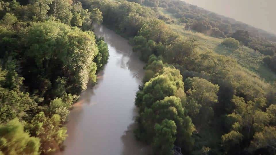
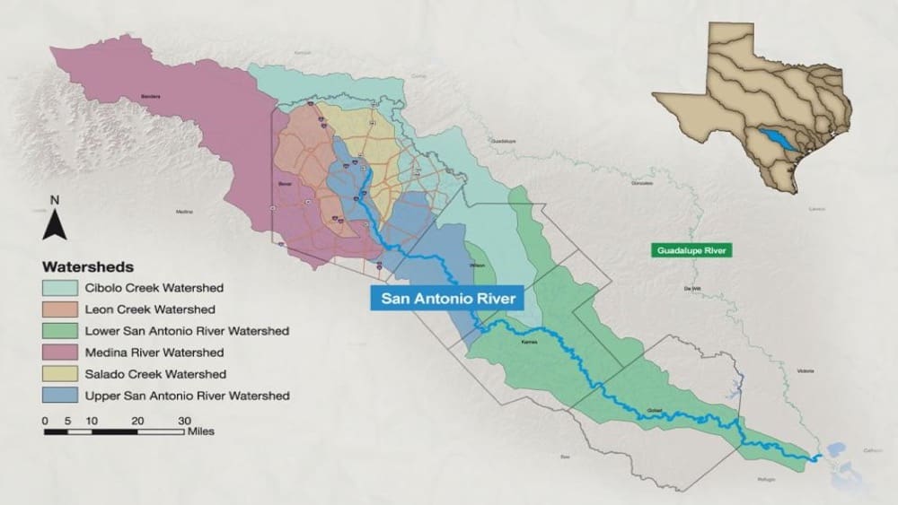
El río San Antonio recorre unas 240 millas a través de los condados de Bexar, Wilson, Karnes, Goliad y Refugio, donde converge con el río Guadalupe antes de desembocar finalmente en la bahía de San Antonio, en el golfo de México. Toda la cuenca del río San Antonio, que es un ecosistema dinámico de arroyos y ríos, drena una superficie de 4.180 millas cuadradas que se extiende desde los condados de Kerr y Medina en el sureste de Texas Hill Country hacia el golfo de México.
¿Cuál es la mayor amenaza para la salud del río San Antonio?
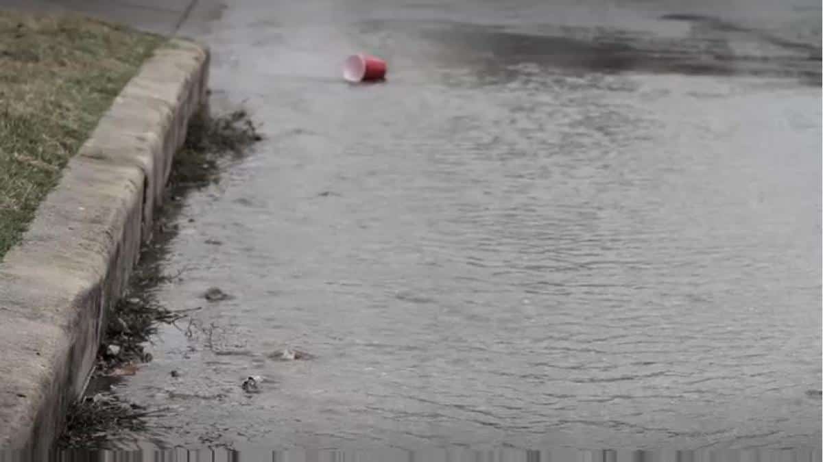
Los datos del monitoreo de la calidad del agua de la Autoridad del Río San Antonio indican que los contaminantes transportados por las escorrentías de aguas pluviales son la mayor amenaza para salud del rioA medida que se pavimentan y desarrollan más superficies naturales, menos agua se filtra en el suelo y, en cambio, más agua pasa por superficies impermeables y llega a los desagües pluviales, recogiendo contaminantes y llevándolos a arroyos y ríos. El agua de lluvia sin tratar que va a los desagües pluviales y directamente a nuestros arroyos y ríos se conoce como escorrentía de aguas pluvialesLos contaminantes recogidos por las aguas pluviales incluyen, entre otros, aceite, fertilizantes, bacterias, metales pesados, gasolina y sedimentos.
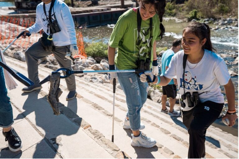
¿Qué se puede hacer para ayudar a proteger el río San Antonio de la escorrentía de aguas pluviales?
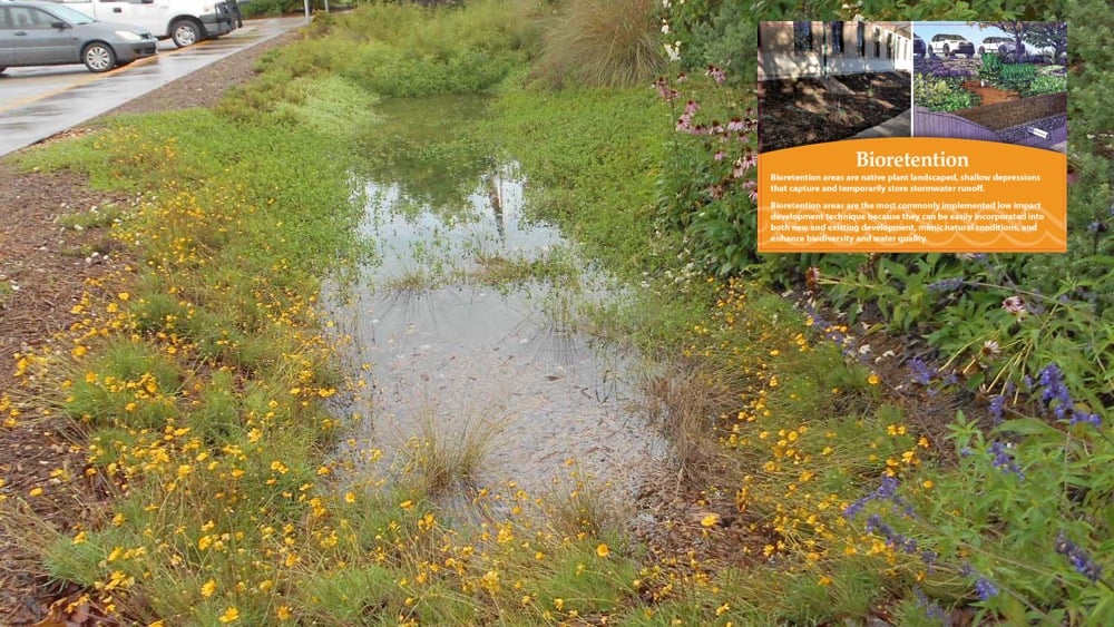
El uso de infraestructura verde y sostenible Se requieren prácticas de gestión de la infraestructura sostenibles para generar mejoras duraderas y reconocidas en la salud del río San Antonio. Además de mejorar la calidad del agua, cada vez hay más pruebas que sugieren que los proyectos que incorporan prácticas de infraestructura verde sostenibles reducirán, a largo plazo, la cantidad de infraestructura necesaria para gestionar las aguas de las inundaciones, utilizarán el agua de lluvia como un recurso valioso en el lugar, tendrán menores costos de mantenimiento, agregarán más espacios verdes, utilizarán plantas nativas, aumentarán la conservación de los recursos, reducirán los costos de mitigación y aumentarán la calidad de vida de la zona circundante. ¡Tu puedes hacer la diferencia! Tus acciones cotidianas, incluso las que parecen pequeñas, pueden tener un efecto positivo o negativo en la salud del río.
¿Qué actividades puedo disfrutar a lo largo del río San Antonio?
La Autoridad del Río opera y administra parques y senderos en toda la cuenca del río San Antonio, donde el público puede disfrutar de una variedad de actividades que incluyen caminatas, ciclismo, remo, campamentos, golf de disco, observación de aves y más.
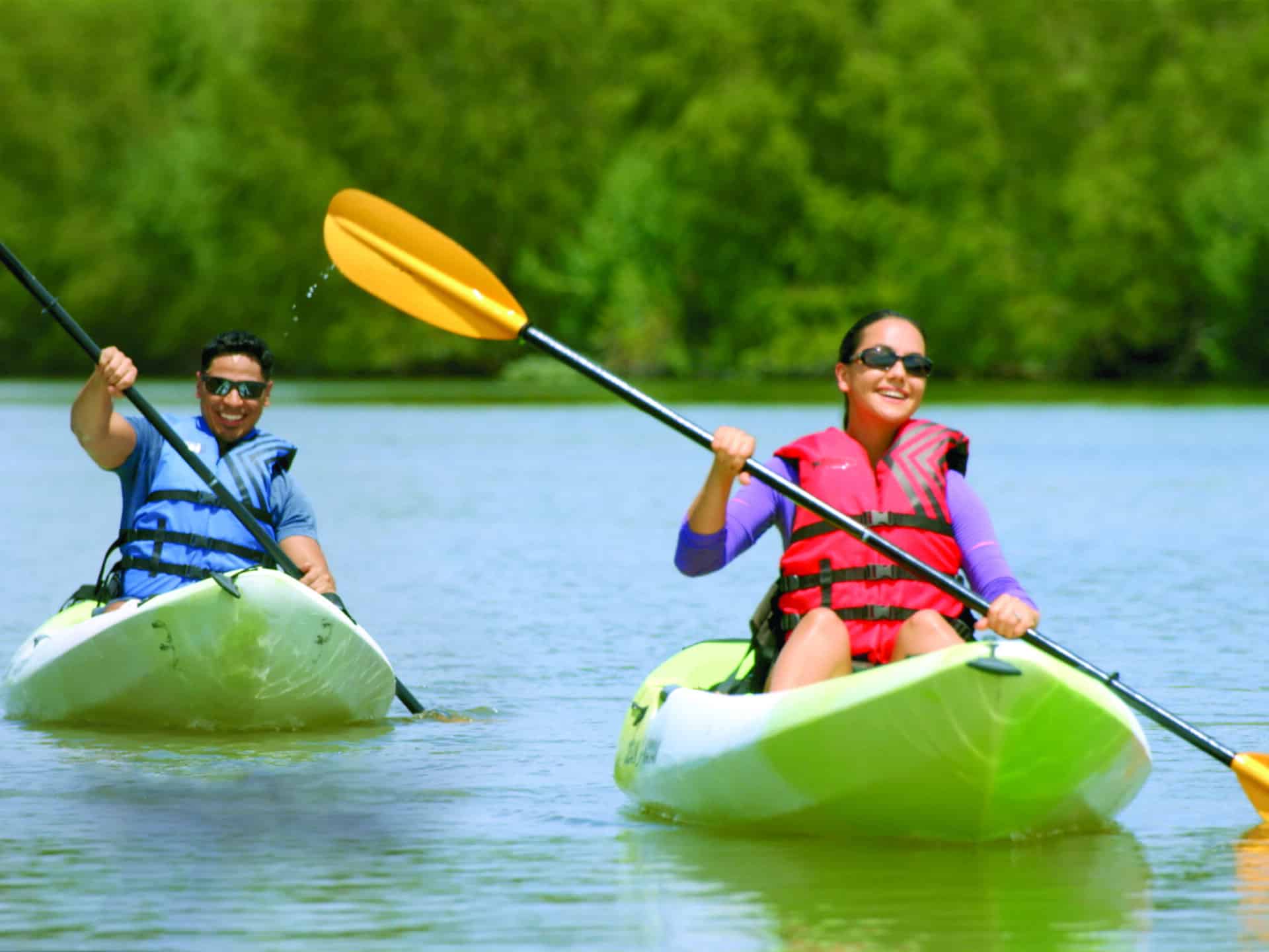
¿Cuántos kilómetros de senderos para caminatas y ciclismo hay disponibles? ¿Cuántos para remar?
La Autoridad del Río San Antonio mantiene más de 28 millas de senderos para caminatas y bicicletas y más de 45 millas de senderos para remar en toda la cuenca del río San Antonio... ¡y hay más en desarrollo!
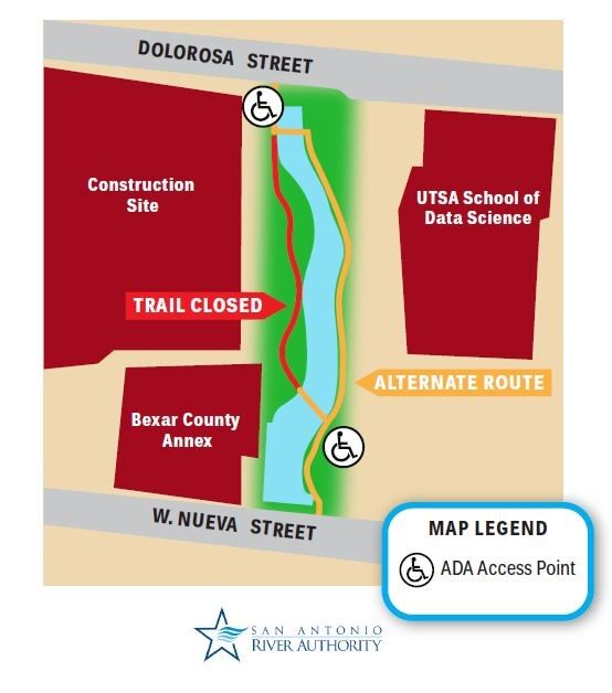
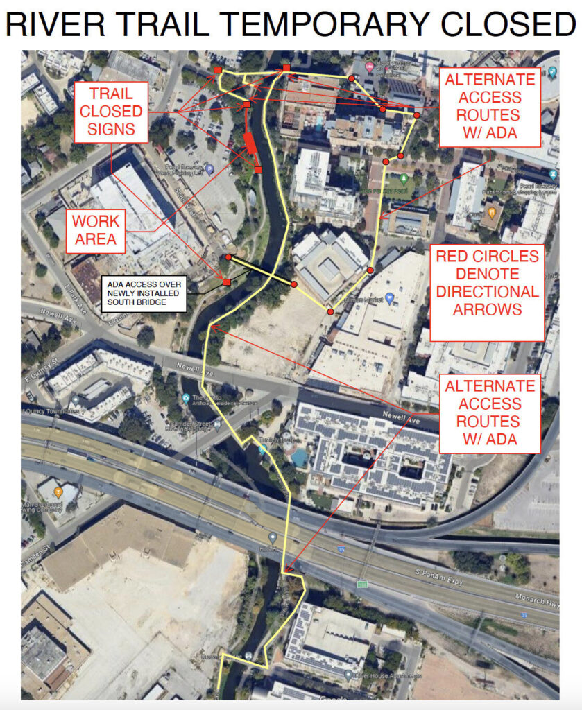
¿Cómo sabré si hay áreas cerradas al público por construcción u otro mantenimiento?
Puede encontrar información sobre las últimas actividades de construcción y mantenimiento en nuestra sitio web.
¿Cómo puedo aprender más sobre el río San Antonio?
Te invitamos a visitar el Educación y Historia Secciones de nuestro sitio web para obtener más información y seguirnos en nuestros canales de redes sociales @sanantonioriver. También puede seguir el recorrido del río San Antonio desde sus orígenes subterráneos hasta el Golfo de México viendo el documental San Antonio to Seadrift. Este recorrido virtual mostrará la diversa vida silvestre y la rica historia del río a medida que pasa por misiones españolas y serpentea a través de los ranchos y las llanuras costeras del sur de Texas.