
Última actualización el 30 de enero de 2024
La serie “My River POV” brinda a los lectores la oportunidad de conocer los conocimientos y las experiencias únicas del personal de la Autoridad del Río San Antonio (Autoridad del Río) y su conexión personal con el Río San Antonio con la esperanza de inspirar la administración de los arroyos y ríos del área.
Karen Bishop, Planning Senior Supervisor-Ecological Engineering
When I was in elementary school, my father built a pop-up camper so he could see if our family liked camping. Little did we know that these family camping trips would open a world of adventure to my younger brother and me.
On campouts, Mom would prepare a full-on bacon and egg breakfast and then turn my brother and me loose. Our only rules were to remain together, be careful, and stay inside the park. My brother’s and my interpretation of that last rule likely differed from our mother’s, as there was always a mountain stream drawing us further away, up into the woods.
Those cold, delicious creeks, their velvety green moss-covered rocks, the swift-as-wind water striders, and the crawdads we scooped up and squealed over kept us busy with child’s play. I have carried this love of nature, fostered all those years ago in the hollows of Southwest Virginia and Northeast Tennessee, with me, including when I moved to Texas 34 years ago.

Brown trout caught on a dry fly, Green River, Wyoming
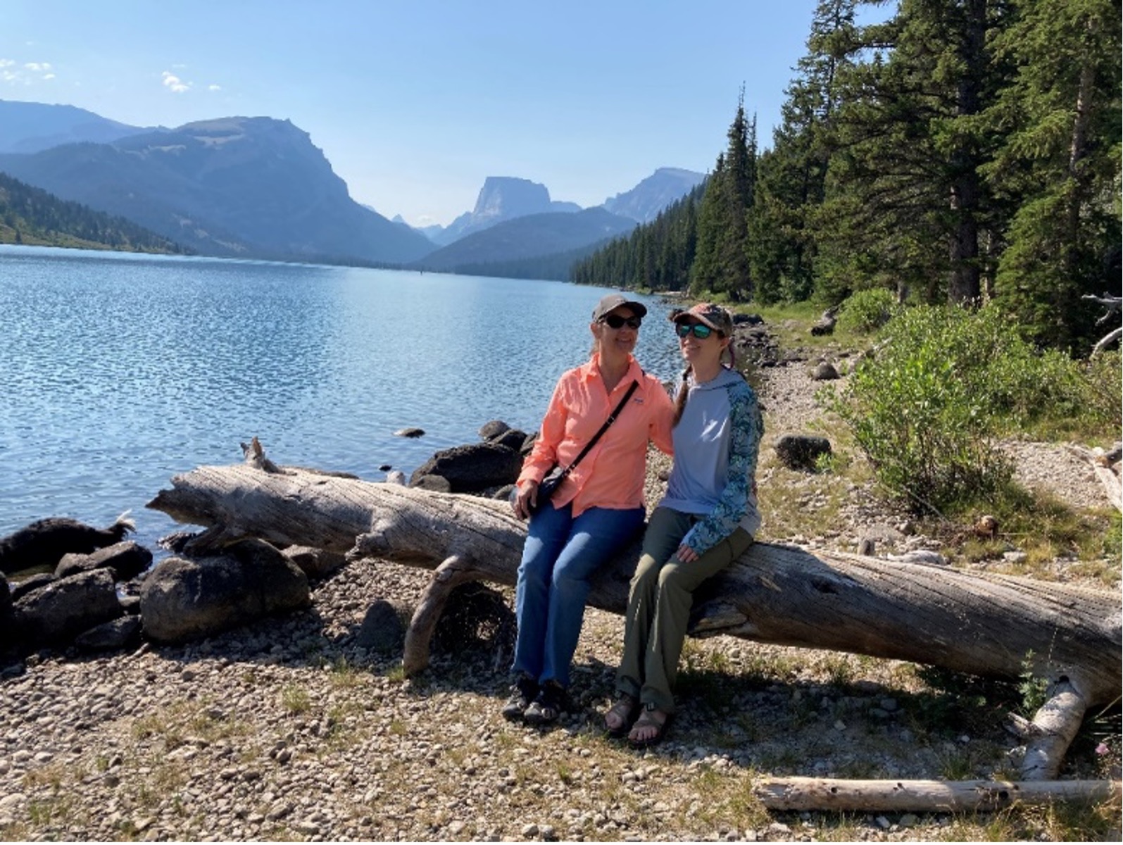
Karen with her daughter at Green River Lakes, Wyoming
Until 2001, my interaction with the natural world was as a recreationist: camping, kayaking, hiking, etc. In 2001, however, I started working at the San Antonio River Authority. Two days later, I was in Goliad County, facilitating a grass-roots group of citizens who wanted to create a canoe trail along the San Antonio River. Those were my early days supporting what would become the Canoe Trail Goliad 501(c)3 and the Goliad Paddling Trail, the first inland paddling trail in Texas to include a State Park.

Karen and her team kayak the Mission Reach
During the next few years, I progressed from being a community relations coordinator supporting the parks and environmental sciences departments to serving as a supervisor. This role required overseeing community relations coordinators, overseeing the board of director agenda process, and transitioning the board’s paper packet into a web-based deliverable.
Goliad remained both a frequent work location and a recreation destination for my young daughter and me. We camped and kayaked there, hiked and biked, volunteered at Tour de Goliad, brought our Girl Scout Troop to kayak the San Antonio River, and ate lots of award-winning jalapeno cheddar cheese soup on the courthouse square.
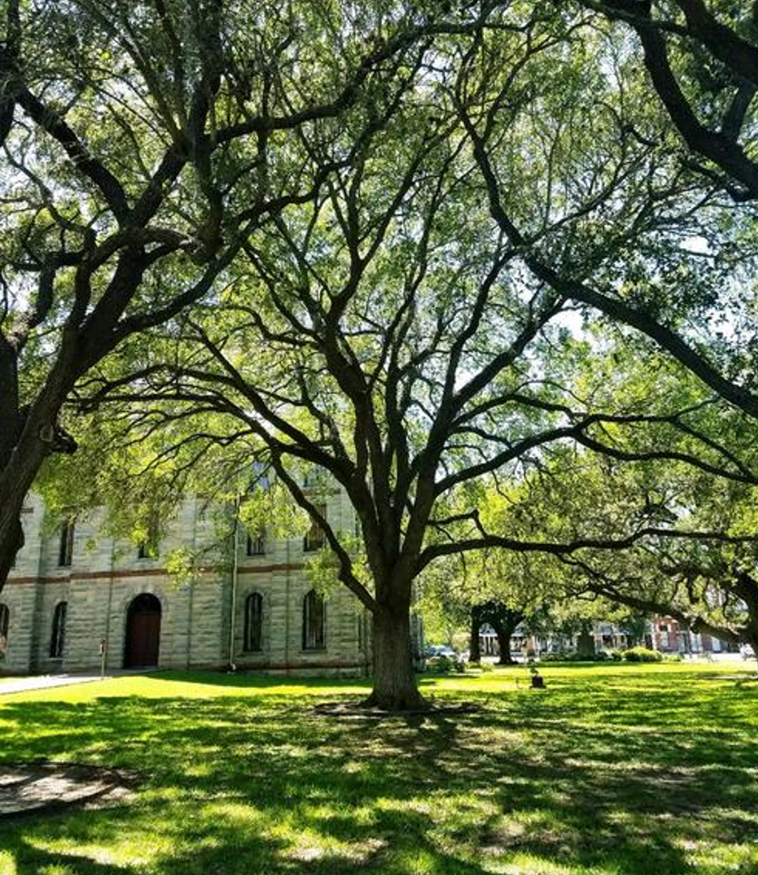
Goliad County Courthouse
It was a 2004 bacteria study, though, that most influenced my professional life. The study revealed that the Lower San Antonio River was within state standards for bacteria in most places, most of the time except during and for about three days following rain events. I read the report and asked around the office, “What can we do?”
That question remained with me until 2010, when I applied for an assignment to research steps other river authorities or water entities were taking to make their watersheds more sustainable. I was selected to lead the research team, and during the upcoming months, we narrowed our options and pitched the top three to management. Desarrollo de bajo impacto (LID) rose to the top.
LID is a toolbox of design options (under the larger umbrella of Green Infrastructure practices) that intercepts and manages stormwater runoff for water quality—the missing component in traditional development strategies that direct stormwater and the pollutants it carries from street to storm drain to stream. Bioretention (aka jardines de lluvia), stormwater cisterns, and permeable pavement are three of the LID strategies that disconnect the path between stormwater pollution and stream.
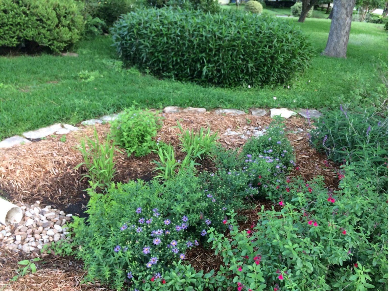
Karen’s side yard rain garden
In other words, LID is an answer to the 2004 question, “What can we do?”
Since then, I have recommended several LID projects that the River Authority has implemented and/or funded: a design manual, credentialing y rebate programs, the City of San Antonio Unified Development Code amendment to define and incentivize LID, and utilizing our science to encourage other agencies and entities to advocate for and implement LID programming.
In hindsight, I suppose it was only a stone’s throw from playing in creeks to working to protect them.
Regístrate en River Reach
Alcance del río es un boletín trimestral de 12 páginas diseñado para informar a los electores de la Autoridad del Río San Antonio sobre los numerosos proyectos de la agencia, servir como vehículo de comunicación para la junta directiva y fomentar un sentido de unidad e identidad entre los residentes de Bexar, Wilson. , Karnes y Goliad.
Si desea ser incluido en la lista de correo de Alcance del río, por favor Contáctenos o Complete el formulario.


