We have recently fielded some questions from the public about the stem density removal work taking place along the Mission Reach of the San Antonio River Walk. Back in October 2020 and again in October 2021, the San Antonio River Authority (River Authority) shared information with the public about this work through traditional media and social media sources and we directly contacted area residents via the Nextdoor app and by sending out direct mail postcards. This blog entry is intended to provide some historical context to the Mission Reach project and help answer the question: why did the River Authority remove trees from the Mission Reach?
River Authority staff removing trees from the Mission Reach.
A Delicate Balance of Project Priorities
The Mission Reach has improved the San Antonio River’s water quality, ecosystem function, and health as well as provided miles of new hike and bike trails and paddling trails for the public to enjoy all while maintaining or improving flood conveyance. That’s quite an accomplishment! It remains, however, incredibly complicated to balance the competing project priorities of flood protection, ecosystem restoration, and recreation. The stem density removal effort is being done to maintain the flood conveyance requirements as set forth by the U.S. Army Corps of Engineers (USACE) and the Federal Emergency Management Agency (FEMA), while maximizing the preservation of the overall Mission Reach ecosystem restoration.
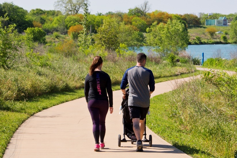
The public enjoys the Mission Reach often unaware of the complicated balance of competing project priorities.
Brief History of the Mission Reach Project
So, how do we determine the ways to best operate and manage the Mission Reach’s priorities that are flood conveyance, ecosystem restoration, and recreation? Some historical context will help tell that story.
The Mission Reach is, first and foremost, a flood conveyance project, although the beautiful native vegetation of the ecosystem restoration and all the wonderful recreational amenities can occasionally obscure the view of that primary objective.
Flooding has plagued the City of San Antonio for generations. Following a devastating flood in 1946, the River Authority began working with Bexar County and the USACE to develop strategies that address flooding in and along the San Antonio River and its tributaries. In 1954, the U.S. Congress authorized the USACE to construct the San Antonio Channel Improvement Project (SACIP). Through the SACIP, the River Authority worked with the USACE on major realignment and channelization to 31 miles of the San Antonio River and its tributaries. This is the origin story of both the Mission Reach and the Westside Creeks Restoration Project. For a deeper dive into the history of the SACIP, click here.
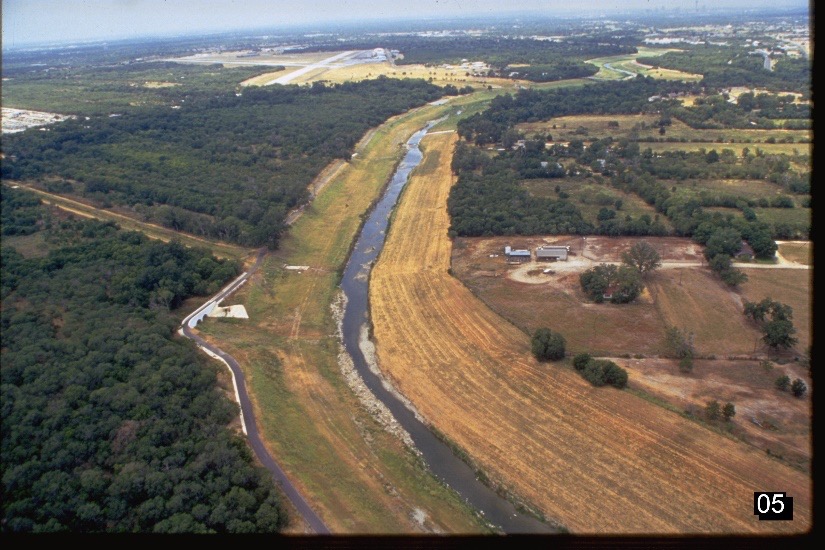
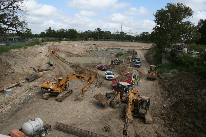
The SACIP channelization before the Mission Reach project.
While the SACIP channelization worked very well for flood mitigation, by the 1990s, citizens were seeking to restore the San Antonio River to a more natural and native habitat. In 1998, Bexar County, the City of San Antonio, and the River Authority launched the San Antonio River Improvements Project (SARIP). Many of the citizens who were advocating for river improvements became members of the newly created San Antonio River Oversight Committee (SAROC). The $384 million SARIP included the Museum Reach and innovative Mission Reach Ecosystem Restoration and Recreation Project (Mission Reach). In June 2008, construction began on the $271.4 million Mission Reach portion of the SARIP, and the project was completed in October 2013.
The USACE, as the federal regulator of the project, was (and remains) the ultimate authority in determining the project design. From the perspective of the USACE, the project priorities in order of importance were: 1) flood conveyance; 2) ecosystem restoration; and 3) recreation. This is still the order of project priorities today.
The challenge of the Mission Reach project was to maintain, or improve, the flood carrying capacity of the river channel, which was the USACE top priority, while implementing ecosystem restoration and adding recreational elements, which were the SAROC top priorities. As the local project sponsor, one of the roles of the River Authority was to be the mediator between the USACE regulatory requirements of the project and the expectations of the local citizens. The River Authority also oversaw construction of the project and is responsible for ongoing operations and maintenance of the Mission Reach.
Adaptive Management of the Mission Reach
The Mission Reach was designed in such a way that the complex engineering principles and construction techniques that were used to maximize the flood conveyance of the channel while minimizing erosion are all largely hidden from public view by the attractive native vegetation of the ecosystem restoration aspects of the project. What can easily go unnoticed by visitors to the Mission Reach is that an enormous amount of engineering effort went into determine how many, of what types, and where could all the new 22,000+ native trees and woody vegetation be planted. This significant planning and construction effort was done to ensure the proper conveyance of flood water while maximizing the restoration of the Mission Reach ecosystem to a more natural and native habitat.
Managing an ecosystem restoration project effectively can be tedious and hard work, but the benefits of the Mission Reach are certainly worth the effort! The River Authority’s Watershed & Park Operations staff uses adaptive management techniques to maintain the Mission Reach. Basically, this means we attempt to adapt our operations to what nature provides us as the ecosystem restoration process matures over time. While adaptive management is a less rigid approach, our maintenance of the Mission Reach is still ultimately confined by the regulatory requirements of the federal government.
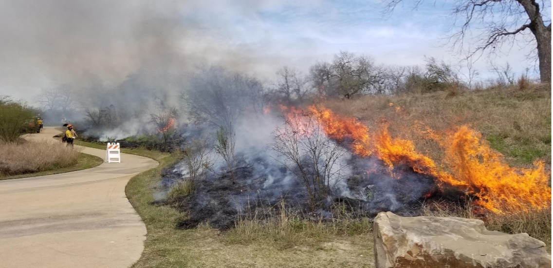
Prescribed burns are used, along with other methods, to properly maintain the Mission Reach.
The Watershed & Park Operations staff uses a variety of vegetation control procedures as part of our adaptive management approach to maintain the Mission Reach. This includes labor-intensive work done by hand, mechanical removal, prescribed burns, and stem removal.
Stem Density Removal
The current stem density removal effort aims to preserve the trees originally planted as part of the ecosystem restoration project while focusing on removing the additional volunteer trees and woody vegetation that arrived on their own since the opening of the project. The River Authority’s engineering staff utilized the most up-to-date floodplain maps along with other engineering software and on-the-ground evaluations to review the vegetation zones along the Mission Reach and update stem density values for stem count per acre that must be achieved to maintain the project’s top federal priority, which is flood protection. These maps show areas that were determined to be the highest priority for the tree removal, and they are what our Watershed & Park Operations staff are using to determine where and how many stems to remove.
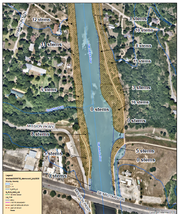
Engineering map showing the acceptable number of stems per acre to maintain flood protection.
Trees are being removed from these areas to meet the regulatory requirements of the USACE and FEMA. A majority (90%) of the trees removed from these areas are “volunteers” that started to grow independently and were not planted as part of the Mission Reach project. The stem density removal work is using a combination of mechanical and hand labor for the removal including two forestry mulchers (mechanical) and hand removal where required at the water’s edge. All the material is being mulched and left onsite to facilitate the quick recovery of the grassland restoration. Roots will remain in place for bank stabilization, and upon completion, remedial seeding and live planting will take place to expedite the grassland restoration.
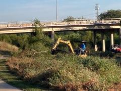
Mechanical method being used to conduct the stem density removal effort.
These areas area being restored to a native grassland prairie habitat and will contain minimal woody vegetation to ensure the proper conveyance of floodwaters, meeting the project’s primary objective. This grassland vegetation is also an important part of the project’s habitat diversity, and even without stems, these areas will continue to support avian migration, other wildlife, and the ecosystem restoration goals of the overall project.
The River Authority conducted similar stem density removal work in other areas of the Mission Reach in the Fall of 2020, and the photos below demonstrate how quickly the grassland restoration can grow.
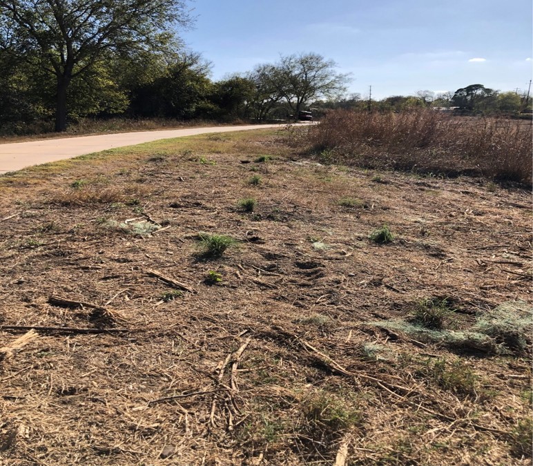
Before: Stem density removal work completed along the Mission Reach in Fall 2020.
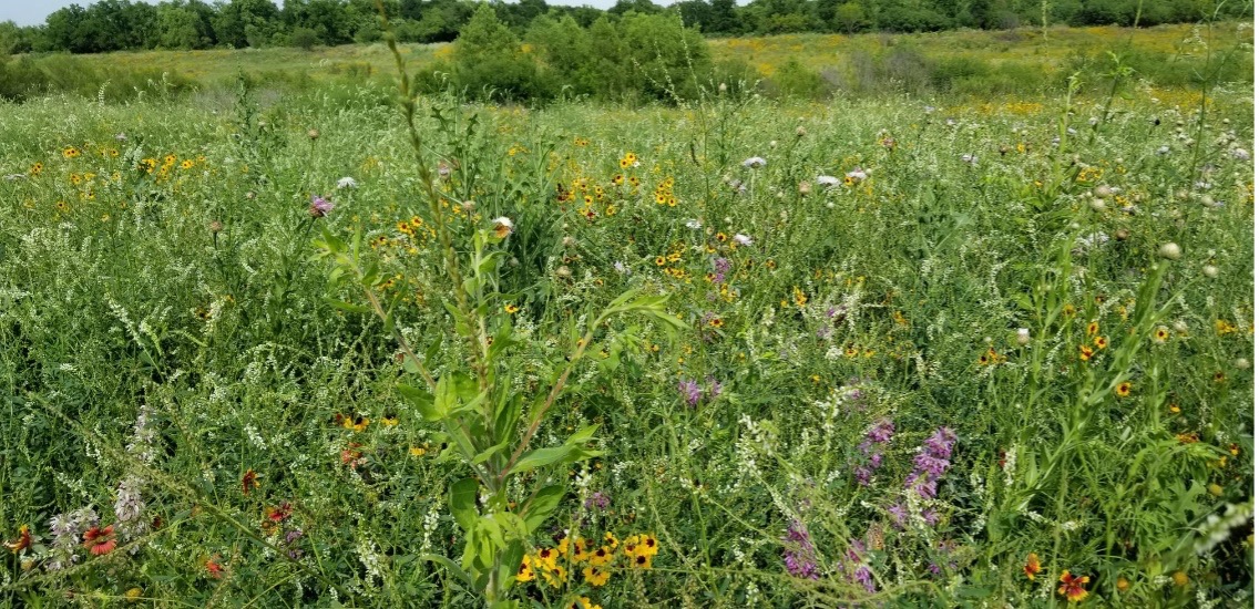
After: Spring 2021, just months after the 2020/21 stem density removal effort.
We greatly appreciate the questions and comments that have been generated by this maintenance work. To us, it shows the public cares deeply about the Mission Reach’s ecosystem restoration. The River Authority shares that passion, from our board of directors, through our scientists, engineers, and other office staff, to the talented operations staff who care for the project each day. As the River Authority’s mission states, we are committed to safe, clean, and enjoyable creeks and rivers. We remain committed to continuing that delicate balance between flood conveyance (i.e., safe), ecosystem restoration (i.e., clean), and recreation (i.e., enjoyable) that has made the global award-winning Mission Reach project beloved by residents and envied by communities around the world.