
Last Updated on March 29, 2024
The “My River POV” series provides readers the opportunity to learn about the unique insight and experiences of River Authority staff and their personal connection to the San Antonio River in hopes of inspiring stewardship of our creeks and rivers.
Stephen T. Graham, PE, CFM, Assistant General Manager
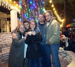
Enjoying the holiday lights in the downtown segment of the River Walk with my family.
My earliest memory of the San Antonio River was as a middle school child visiting the River Walk during the Christmas season to see the holiday lights. Like many San Antonians, it was a family tradition that usually included dinner and a barge ride. Even when we would occasionally visit one of the Missions, neither that the river was nearby nor its importance in the history of our city ever occurred to me. Other than our annual visits to the River Walk, for me and my parents, the river wasn’t really understood or appreciated. No wonder, because much of the natural beauty and community connection to the river ended in the 1960s when it was straightened and denuded to alleviate severe flooding in our city. For decades after that channelization, the river looked like an engineered trapezoidal ditch serving a single purpose…flood control. An important purpose, but not one that captured the heart and attention of a child.
That all changed in 2013 when the river south of downtown had a major make-over. Largely with the use of Bexar County and federal funds, it was transformed into one of the largest restored urban rivers in the nation. This portion of the river is now known as the Mission Reach and has nearly 450 acres of restored aquatic and riparian habitat, over 16 miles of hike and bike trails, a paddling trail, various park amenities, and plenty of great locations for fishing. This was all done while maintaining the important flood control function. Additionally, in 2015, the restored San Antonio River was part of the reason San Antonio’s five Spanish Colonial Missions were designated as a World Heritage Site. The Mission Reach is now a huge source of community pride, recreation, and economic development.
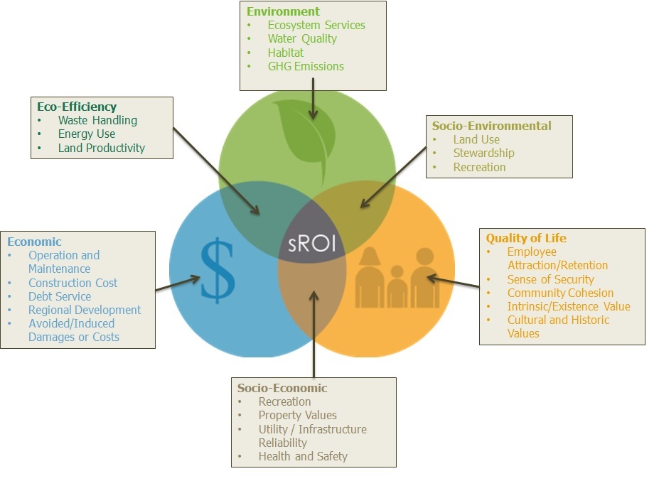
In fact, the Mission Reach is seen as the ideal, multi-purpose, public works project that exemplifies what is known as the Triple-Bottom-Line (TBL). A TBL approach optimizes the social needs (people), the environment (planet), and cost (profit).
Many communities, businesses, and governments like the River Authority, define and measure sustainability using the TBL approach. While capital and operational costs are crucial, so are social issues like healthy living, equity, access to green space, and culture/heritage. Of equal importance are environmental issues like water quality and quantity, heat island, air quality, and floodplain protection
It’s also a great example of the San Antonio River Authority’s efforts to harmonize the needs of people and nature through our stewardship of rivers and land. By forging positive connections to our creeks and rivers, we hope others will join us in our efforts by volunteering or learning what they can do in and around their own homes to protect and preserve our natural resources for future generations.
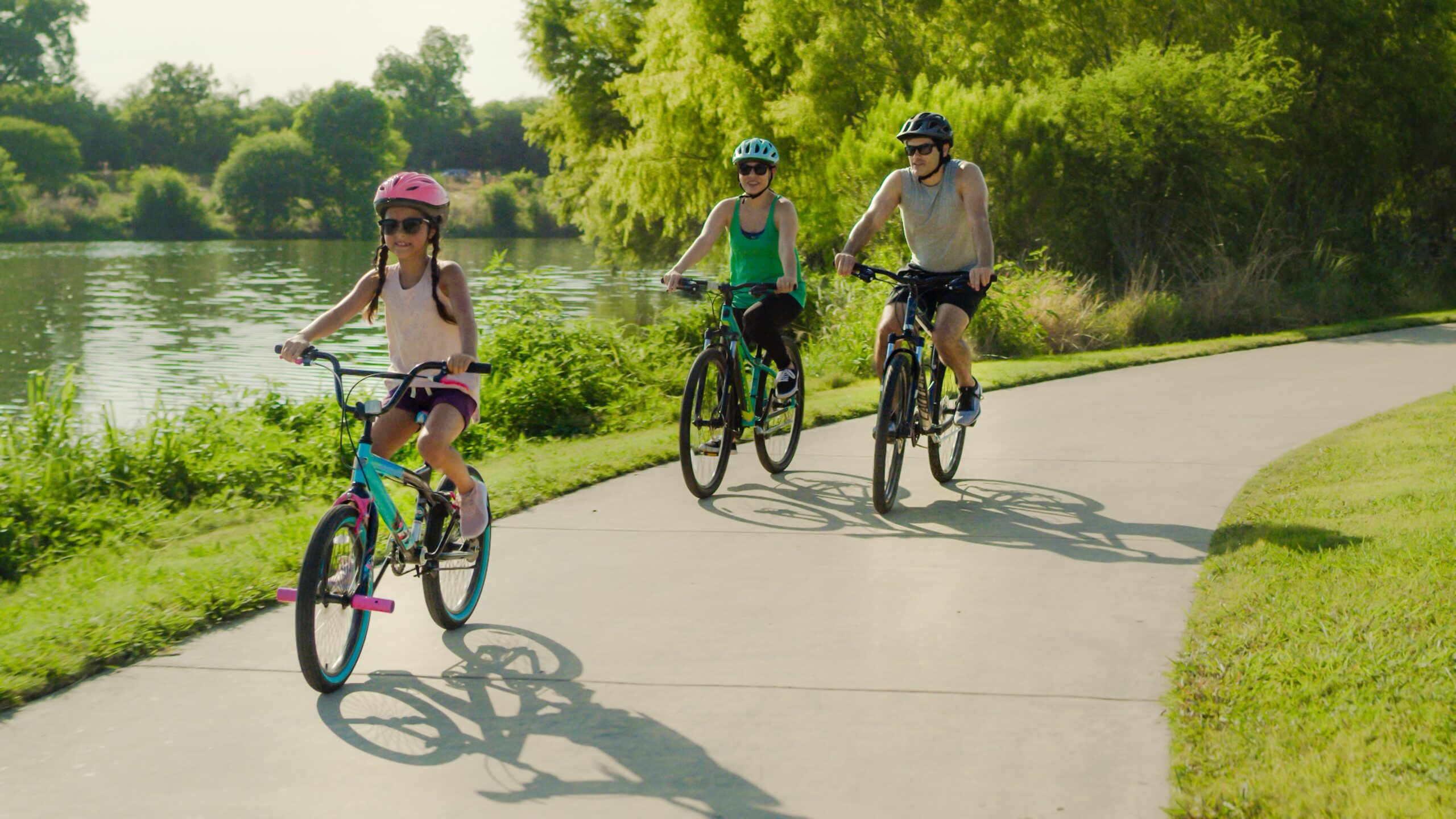
Enjoying a bike ride along the Museum Reach San Antonio River Walk segment with my daughter.
Every time that I walk on the river now, especially the Mission Reach, I’m proud to see that it is again a treasured community asset that reconnects people physically and emotionally to our beautiful San Antonio River which is much more than the River Walk. That’s priceless.


