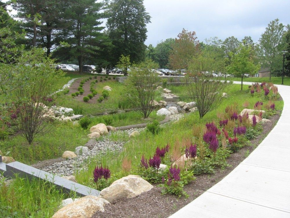
A rendering design based on the GI model for the City of San Antonio’s Windsor Park.
Green infrastructure, which is a group of design practices that function like green space and natural areas to slow, detain, and filter stormwater, has been applied and promoted by the San Antonio River Authority (River Authority) over recent years as part of our commitment to safe, clean, enjoyable creeks and rivers.
The River Authority was awarded a Clean Water Act Section 319(h) Grant by the U.S. Environmental Protection Agency, administered by the Texas Commission on Environmental Quality (TCEQ), to develop a master plan for the use of green infrastructure (GI). Read along as we share more information about the GI Master Plan and the positive impact it will have on the communities we serve!
Green Infrastructure Benefits
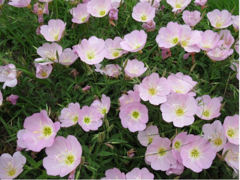
A residential rain garden in action capturing stormwater during a rain event.
As more natural surfaces are paved and developed, less water percolates into the ground and more water instead goes over impervious surfaces and into storm drains, picking up pollutants and carrying them to creeks and rivers. The rainwater runoff that goes into storm drains and directly to area creeks and rivers is known as stormwater runoff. In the San Antonio River Basin, stormwater runoff is not cleaned at a treatment plant before being discharged into the environment. This means the pollutants picked up by stormwater, which can include oil, fertilizers, bacteria, heavy metals, gasoline, and sediment, drain directly into area creeks and rivers.
Traditional stormwater infrastructure is designed to manage stormwater volume, not stormwater quality. GI are constructed features that add the stormwater quality component by mimicking the predevelopment hydrology of an area. Examples are bioretention basins (commonly known as rain gardens) and swales, extended detention basins, constructed wetlands, vegetated filter strips, cisterns, and permeable pavement and pavers. They are designed to clean and reduce local flooding by capturing and treating stormwater runoff pollution before it enters local creeks and rivers.
The Clean Water Act Section 319(h) grant funds a River Authority project that builds off recommendations made in the Upper San Antonio River Watershed Protection Plan (WPP) to implement GI to reduce stormwater runoff pollution and addresses measures in the Texas Non-Point Source Management Program. Ultimately, the goal is for the GI Master Plan to become a template for all sub-basins not meeting water quality standards throughout the San Antonio River Basin.
GI Master Plan’s Community Impact
Since GI is still relatively new to the San Antonio River Basin, the master plan aims to guide decision-makers on where and how to apply limited resources in the upcoming years to maximize water quality benefits while addressing local flooding concerns. The River Authority incorporated stakeholder input to identify and build on common goals and investment priorities for implementing GI.
The River Authority’s watershed scale models have identified sub-basins or small watersheds that have the highest stormwater pollutant load reduction potential. This project used existing data and modeling tools to identify and prioritize sites within those areas that have the highest potential for GI implementation effectiveness. Properties considered for implementation included public lands, schools, capital improvement projects, city planning areas, and neighborhoods with supportive stakeholders such as homeowner’s association partners.
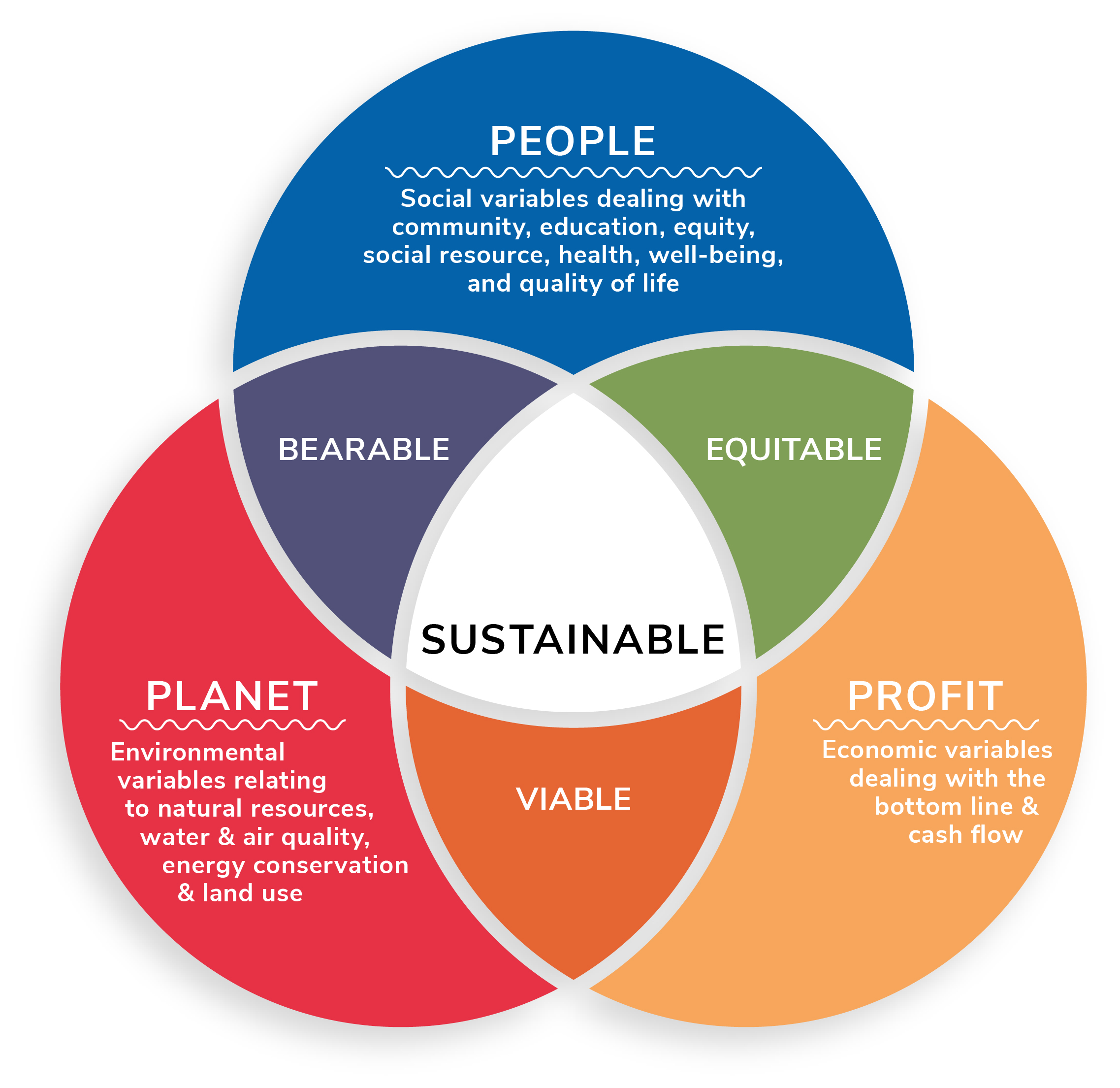
The GI Master Plan will include a recommended schedule of implementation, the stakeholder process, costs, funding considerations, and the overall evaluation and prioritization process – all as examples communities can use for their own decision-making. The GI Master Plan will also include an evaluation of Triple Bottom Line benefits (social, environmental, and economic).
Learn More About Green Infrastructure!
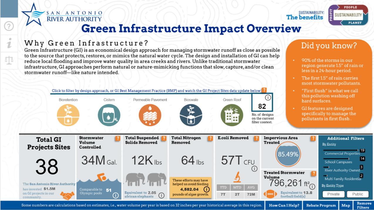
We invite you to explore the River Authority’s new dynamic Green Infrastructure Dashboard in hopes this inspires more people to employ green infrastructure strategies that will result in healthy creeks and rivers. You can also request a presentation with a River Authority staff member to gain more insight and learn more about our efforts.